The North Carolina Senate has released some of the congressional redistricting maps submitted, and several split Guilford County into three congressional districts.
All of Guilford County and an eastern portion of Forsyth County currently make up the 6th Congressional District, which is represented by Democratic Congresswoman Kathy Manning.
When the congressional districts were redrawn before the 2020 election, the 6th District went from being a Republican district to a Democratic district.
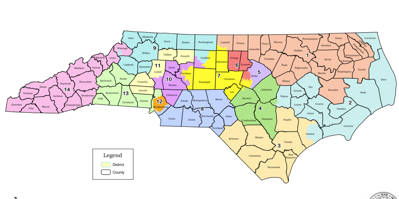
Map CBK-3 puts High Point and the southwestern corner of Guilford County into the 10th District with Davie, Rowan and Cabarrus counties and portions of Davidson and Iredell counties.
The eastern portion of Guilford County, including much of Greensboro, would be in the 7th District with Alamance, Randolph, Chatham, Lee counties and parts of Wake and Harnett counties.
The northwest portion of Guilford County, also including a good portion of Greensboro, would be in the 9th District with Rockingham, Stokes, Surry, Alleghany, Ashe, Wilkes and Alexander counties and a portion of Watauga County.
The state’s two largest counties, Wake and Mecklenburg, are also be divided into three congressional districts by map CBK-3.
Both maps CBK-4 and CBK-5 would keep the 6th District pretty much as it is with all of Guilford County and a portion of Forsyth County that includes most of Winston-Salem.
Map CST-2 also divides Guilford County into three districts with a somewhat similar configuration to CMK-3. Parts of Guilford would be in the 7th District, the 9th District and the 10th District.
Major changes will have to be made in the North Carolina congressional districts regardless of what happens to Guilford County. Because of its growth in population, North Carolina gained a congressional seat in the 2020 Census and the state will have to be divided into 14 equal districts rather than the current 13.
In accordance with the Census figures, each district should be drawn to have a population of 745,671. Unlike City Council districts or Board of Commissioner districts, where a deviation of up to 5 percent is allowed, congressional districts are supposed to be as close to that 745,671 number as possible.
For example, in map CST-2, eight districts are exactly 745,761 and six districts are at 745,760.

I like it. Any change that takes me out of the Sixth District and possibly removes Kathy Manning as a US Representative is a positive move. She has been completely inattentive to her constituents and merely voted the Democratic mantra, likely so as to be awarded House funds for her reelection. Even to the extent of throwing the entire state of NC under the bus by voting for HR1, which would remove the federal election process from control of the state election board and remove our state legislature’s ability to redistrict it’s own population as it sees appropriate. As if the Federal government knows our state better than our own local reps. Shame on Kathy Manning.
Every written communication I’ve submitted has received a canned response stating that due to volume she cannot address my concerns directly. I don’t call that representation. But with this proposed map, we could likely say ‘Good riddance’.
I’d be happy with either the 9th or 7th District for the same reason. Manning has been a “Yes, man, Progressive Democrat”, who doesn’t represent the majority of previous 6th District constituents. I’d appreciate being back in a district where I’d feel like I’m once again being heard.
Yes, the district was created for the democrats as a result of a legal challenge by Obama’s former Attorney General. Manning and her husband have few connections to the average Guilford County voter, only those with $$$$.