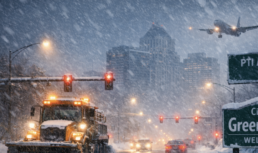
If you live on a major road like, say, West Cornwallis or North Elm, you’ve probably been pretty pleased at the way the city has cleared your streets. However, those who live on some secondary roads – well, maybe not so much so.
Still, city officials say they’ve been working very hard to get those back roads in better shape.
However, since this area is about to get hit with another blast of snow, those current street clearing efforts may be all for naught.
Greensboro is still struggling to fully recover from the previous winter storm this week, and now another, potentially more dangerous system is bearing down on the city – with heavy snow expected to arrive Friday night or early Saturday.
In fact, earlier this week the weather people were warning there might be a very scary weather event called a “bomb cyclone” – short for “bombogenesis.” That’s a rapidly intensifying winter storm in which air pressure drops dramatically in a short period of time – typically at least 24 millibars in 24 hours.
That sudden pressure collapse causes the storm to strengthen quickly, often producing extremely strong winds along with heavy snow or rain and widespread power outages. Earlier forecasts suggested the system approaching central North Carolina might develop that way, but the latest data shows the storm intensifying more gradually, with its main impacts coming from snow accumulation rather than wind.
As a result, while the storm is expected to be disruptive and dangerous for travel, it likely won’t meet the technical criteria needed to be classified as a true bomb cyclone.
City crews were still clearing streets and finishing cleanup work Friday afternoon, but much of that progress may soon be erased: The National Weather Service has issued a Winter Storm Warning calling for five to eight inches of snow across the Piedmont, with hazardous travel conditions expected through Sunday morning.
Despite icy temperatures and refreezing overnight, the city says it’s made significant progress this week clearing roadways from the previous storm. According to city officials, the entire Priority 1 street network – roughly 1,800 miles of multi-lane and high-traffic roads – has been cleared to bare pavement.
Priority 1 streets account for nearly 75 percent of Greensboro’s total 2,500-mile street system, with most of that work being completed earlier in the week on Monday and Tuesday.
The city also reports that most of the Priority 2 network, totaling 524 miles of collector streets that connect neighborhoods to major roads, has been cleared to bare pavement as well.
That work was largely completed by midweek.
Residential streets have seen progress too: All 727 miles of Priority 3 streets have been plowed at least once, with many receiving multiple passes as crews worked to improve conditions.
In areas where plowing and salting haven’t been enough, crews have continued applying calcium chloride and using motor graders to break up stubborn ice and reach the goal of bare pavement.
City officials say those targeted treatments have been critical in addressing slick spots that refuse to melt in freezing temperatures.
Solid waste collection, which was suspended earlier in the week, is now caught up on all passable roads. The city says 100 percent of accessible routes have been completed for trash and recycling pickup.
Any carts not collected by the end of business Friday should be removed from the curb and will be serviced during next week’s regular schedule. All commercial and multi-family routes are complete.
Bulk and yard waste collection will be suspended next week and is expected to resume February 9.
While crews have been clearing roads, the city has also been preparing for the next round of winter weather. Snow plows were mobilizing Friday in advance of the approaching storm – and much of the roadway network has already been salted. Officials say salt and calcium chloride supplies are being replenished, all equipment is operational and crews are ready to continue response efforts throughout the weekend as conditions require.
The City of Greensboro’s snow removal targets for the upcoming storm call for clearing 90 percent of Priority 1 routes within 36 hours after snowfall ends, 75 percent of Priority 2 routes within 48 hours and 75 percent of Priority 3 routes within 72 hours.
If new snow accumulates, as is highly likely, the city’s snow removal map will be reset.
At Piedmont Triad International Airport, preparations are also underway for what could be a difficult air travel weekend. Airport officials say snow crews will be on duty around the clock to keep the airport operational. The airport plans to remain open; however, airline schedules may be disrupted, and passengers are urged to check with their airlines before leaving home.
Airport roadways will be maintained continuously, though officials caution travelers to drive carefully both at the airport and on surrounding roads. Depending on conditions, the airport authority may close the upper departures and ticketing level and re-route all vehicles to the lower level, which is better protected from precipitation. The Premium Deck parking area is currently closed.
Forecasters warn that roads – especially bridges and overpasses – could become slick and hazardous, with travel difficult or even impossible at times Saturday into Sunday. County residents are being urged to delay travel if possible and to use extreme caution if travel is unavoidable.


.
I think I’d like a Bimbogenesis….